 |
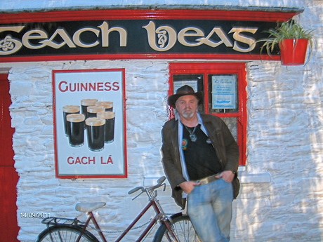
| 'An Teach Beg' pub, Clonakilty, Co. Cork [Photo: RMcC] |
Well, last week Gerry and I took a much-needed wee break and travelled the length of the country right down to Cork – stopping off in Dublin on the way. The road is motorway the whole way from Belfast, now – so you can cover the length of Ireland in just a few hours – with a few toll plazas on the way! We'd a great meal in the centre of Cork City, at a restaurant called, 'The Strasbourg Goose' – don't ask me for directions, but I think it's just off the main Patrick Street.
Our host, Doug, then took us to a very small pub, upstairs, where they have a great collection of unusual beers – lots of blond beer and a draught stout called, Dark Rocket, which tastes a bit like Murphys, only with a stronger flavour. If you like stout then Cork City is great place to be, with two locally-brewed varieties – Murphys and Beamish – each quite distinct from Dublin's Guinness. Ye'll have to make up your own mind as to which ye prefer. Myself, I like them equally, but it's great to have a bit of variety.
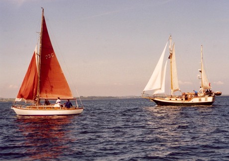
We'd wanted to see West Cork, but we were staying just outside a wee place called Ladysbridge, in East Cork, which has a lovely thatched pub in the middle of it. The coast in not far from there, so we took a trip the first day from Ballycotton Harbour, with its islands and lighthouse, right around the coast to Whitegate, facing Cobh and Cork Harbour – where we managed to see the QE II liner heading out of the harbour on its way to New York!
East Cork is very reminiscent of Cornwall, another beautiful coastal area, which we visited briefly a few years ago. The shore is mostly cliffs from Ballycotton on, with small lanes (boreens) leading down to isolated beaches between headlands. Each of these little beaches is different in character, but exploring them means driving down to the beach, then back up again, to continue along a level country road lined with barley fields above the cliffs. To get from East to West Cork you have to rejoin the main road to Cork City, bypassing Cobh, which is another beautiful town built on an island in Cork Harbour. The road now goes through a new tunnel under Cork's two rivers and continues as the South Ring around the city. Eventually you turn south off this and you're immediately back in the countryside.
West Cork is a part of Ireland I've never been to before – and I was slightly disappointed to discover that there are few small harbours along the coast – in fact, most of the towns are large and slightly inland from the sea. We only got as far as Clonakilty, that first evening, which has a beautiful, sheltered and still sea inlet, which just touches the outskirts of the town. There is a river through the middle of the town, of course, and the narrow streets criss-cross it, as do several buildings. We were looking for a pub called, 'An Teach Beg,' which means 'the wee house,' boasting Irish music every night but, being September, it was actually closed until the weekend!
Ever resourceful, we managed to find another pub on the main street, De Bearra's, which had a collection of fiddles and other instruments on the wall – a good sign! – and some live acoustic music later on. The next day we were off to the far west, to Glengarriff, on Bantry Bay. Glengarriff is a great place if you're a tourist wanting to buy stuff – its main attraction being the Italian Gardens out on Garinish, or 'Garden Island,' reached by a small boat. After a wee nap, we headed on to the fishing port of Castletownbere, on the Bearra Peninsula, which has a small car ferry which will take you out to the large Bear Island. Castletownbere is the home of the now famous, McCarthy's Bar, just off the Square, and across from where I had a great feed of freshly made chowder – and another pint of Beamish, of course.
 |
| Ricky Lynch, in Henchy's, Cork City |
By now struggling to keep awake, we negotiated the mountain road to the other side of the Peninsula, joining the Ring of Bearra again. Suddenly you find yourself in Co. Kerry, with Kenmare Bay on your left. Eventually, we crossed the bridge into Kenmare itself, and back to the City. We were just on time to meet our friends there, and up to Henchy's Pub at Dillon's Cross, to hear a man called Ricky Lynch. A bit of early Beatles, Bob Dylan and, when we managed to persuade him, his own material – which was great! Very Dylan-esque! You'll find a photo of Ricky on our facebook page, and I hope to play one of his songs as soon as I get the CD.
Our friends were off to Israel on Friday so we were off to Co. Clare, via the old main road to Limerick and then the very impressive new Shannon Tunnel – motorway now the whole way to just outside our destination for the night, Newmarket-on-Fergus. Our friends there live in Tim's great-grandfather's house, which used to be a grocer's shop – with an old iron safe built into the wall. Up on Saturday morning just in time to see Ireland finish knocking the stuffing out of Australia in the rugby world cup! They say a change is as good as a rest so, on that basis, we had a very restful week!